Geographic Data Viewer
Advertisement

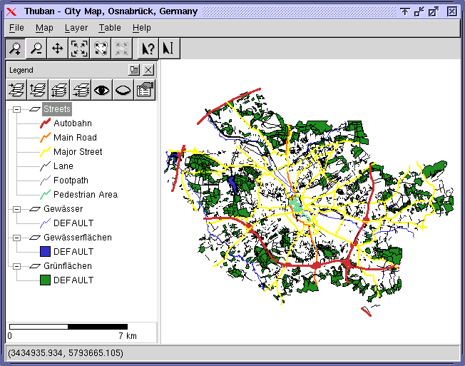
Thuban for Mac OS X 1.0.1-3 v.3
Thuban is an interactive geographic data viewer (GIS viewer) which features methods to visualize, explore, and analyze geographic information.
Advertisement
Thuban for Windows v.1.2.2
Thuban is an interactive geographic data viewer (GIS viewer) which features methods to visualize, explore, and analyze geographic information.
FCS Viewer v.2.0
Fluorescence Correlation Spectroscopy (FCS) data viewer.
ArcExplorer v.4.0.1
ArcExplorer is a lightweight GIS data viewer developed by ESRI.
ECGMonitor v.1.0
ECG Monitor is a real time 12 channel streaming ECG data viewer software that can be easily adapted to your ECG acquisition hardware. Fast signal drawing algorithms make use of direct Windows API's.
Global Mapper v.12.00
Create Better Maps with Global Mapper. Think of it as a word processor for geographic data. With a digital representation of your data, you can create printed maps or digital map files that can be downloaded into Garmin GPSr's.
3DGIS Cityvu v.0.9.6.3
Cityvu is a 3D GIS data viewer able to load CityGML data format from any compatible data source. Cityvu features 3D hardware rendering using OpenGL with a complete navigation system that allows automated tour of the rendered scene.
Cadcorp SIS Map Browser v.7 1
Cadcorp Map Browser is an application which allows the user to browse OGC® standard geographic data served on the web. Global demand for open systems interoperability is accelerating. Open Geospatial Consortium, Inc.
ArcGIS Military Overlay Editor v.10.0.2414
Military Overlay Editor (MOLE) is a set of COM components for developers to create custom applications that support Department of Defense . With MOLE, you can - Add geographic data while composing and positioning unit symbols.
EchoPostSurvey v.2 52
Free data viewer for : Knudsen Echosounder Data Files , XTF Side Scan Data and SEG-Y Data.
AGIS for Windows v.2002
AGIS for Windows is a mapping and simple GIS shareware package. Plot your own geographic data on the map of the world provided without the high cost and steep learning curve usually associated with this kind of software.